
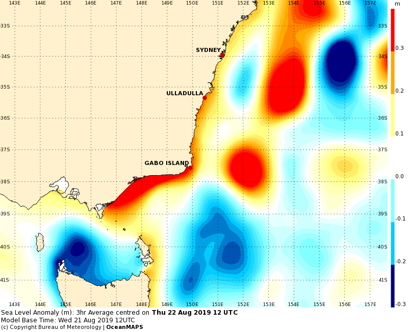
SST update
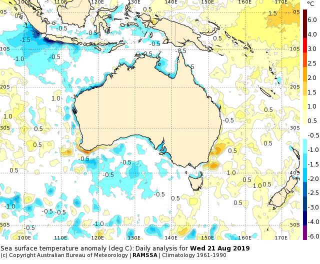
Weak cool anomalies surround much of the country, including the Great Australian Bight and the tropics. A big cold patch off southern Sumatra is due to upwelling. As mentioned last week, this is causing cool SSTs in the eastern IOD box and has led to a jump in the IOD index.
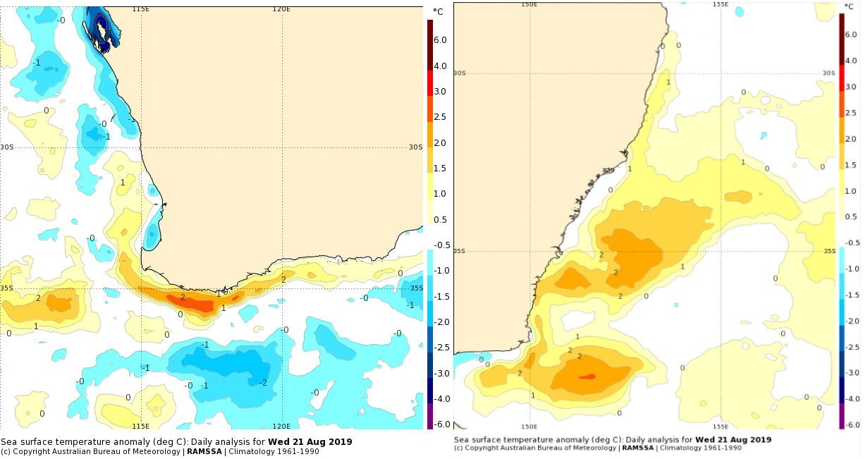
There are two significant warm areas. Firstly, the southwest corner of WA where it is 2 to 3 degrees about normal just to the south of Albany and also further west in a warm eddy. The other hot spot is along the NSW coast.
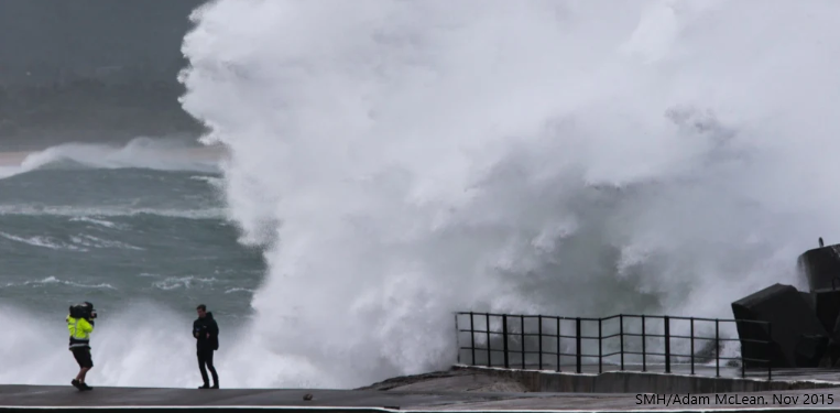
Damaging and hazardous surf
A southerly surge up the east coast this week caused winds, waves and sea levels to spike. The media has speculated on batterings from fierce gales and likely coastal erosion.
The Bureau has issued warnings for Hazardous Surf and Damaging Surf.
‘Hazardous Surf’ is used to describe conditions that are not safe for swimmers, boaters and fishers.
‘Damaging Surf’ is when the conditions are likely to cause damage to property or significant coastal erosion.
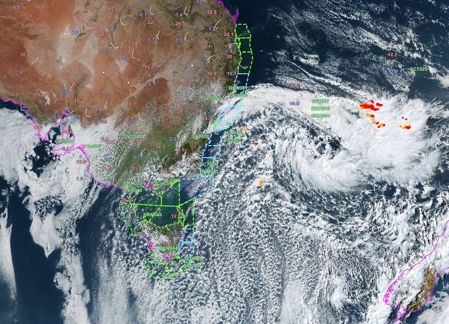
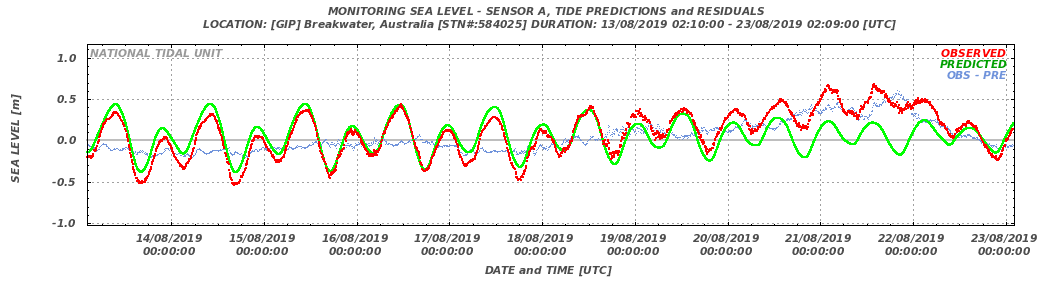
The sea level has surged along the southeastern coast and formed a coastally trapped wave. Yesterday the CTW was seen along eastern VIC and southern NSW. Today it has moved to northern NSW and it will reach southern QLD on Saturday.
The surge in OceanMAPS verified well yesterday, when a tide residual of 0.55 m was measured at Lakes Entrance.
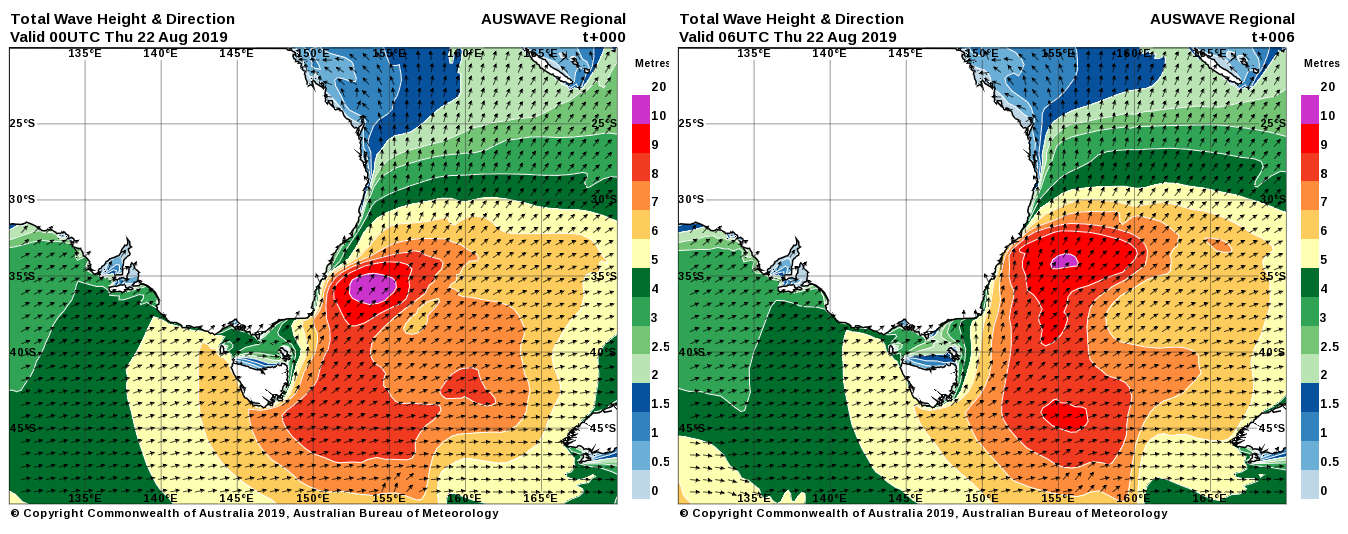
But what about the waves?
Whopping significant wave heights up to 10 to 11 m were expected in the western Tasman Sea yesterday. The worst impacted place would be Lord Howe Island.
[I can’t find any online reports or photos from Lord Howe Island – hope everything it OK out there]
The large sea state has also caused notable wave setup along the mainland coast. The National Storm Surge model showed wave setups of 0.6 m along NSW, particularly on southfacing shorelines like near Newcastle.
Large wave setup + moderate coastally trapped wave + small (neap) tides = minor HAT exceedences on exposed coastlines.
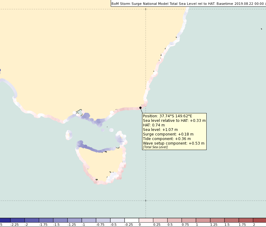
The National Storm Surge model indicated up to 15 cm above HAT in many places. This is not extreme, but wave over-topping is an additional factor that would have increased the risk of coastal erosion.
What have we seen so far?
Not many photos have yet emerged, no doubt because the event is still ongoing.
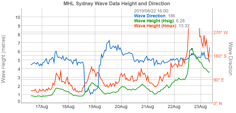
But we can see measurements that have backed up the wave forecast. Yesterday (Thursday) afternoon a significant wave height of 6.3 m was measured at Sydney buoy. The maximum wave was 13.3 m! An eyeball of the station history table shows that since 1993 that Hmax number has only been beaten once before with a 13.8 m recorded in June 2012. [Other NSW stations have recorded higher].
A report published this week in Nature Climate Change by CSIRO researchers, shows that 50% of global coastlines will be affected by changes in wave climate. Some areas will see increasing wave heights and some will see decreasing wave heights. Mean wave directions are also set to change by up to 15 degrees in places.
The trend may mean this “quite rare event” for NSW may not be all that rare in times to come.
Arctic hotspot
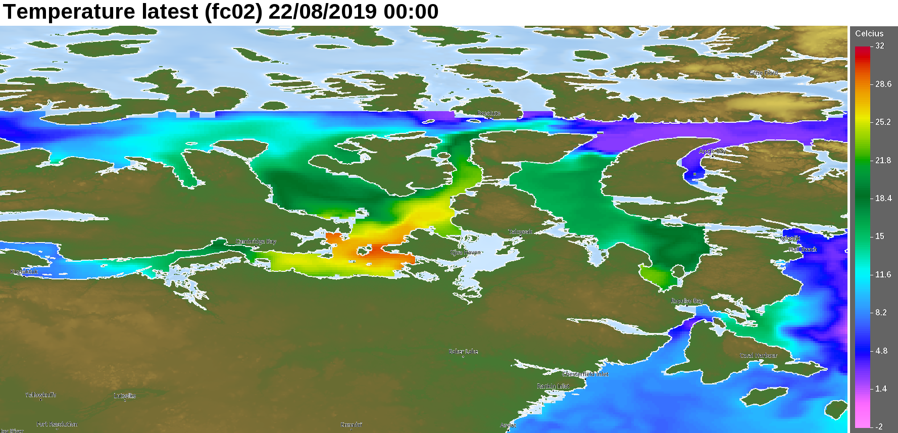
A hot well in northern Canada has developed in OceanMAPS.
SSTs are approaching 30 deg C – enough for a tropical cyclone to develop.
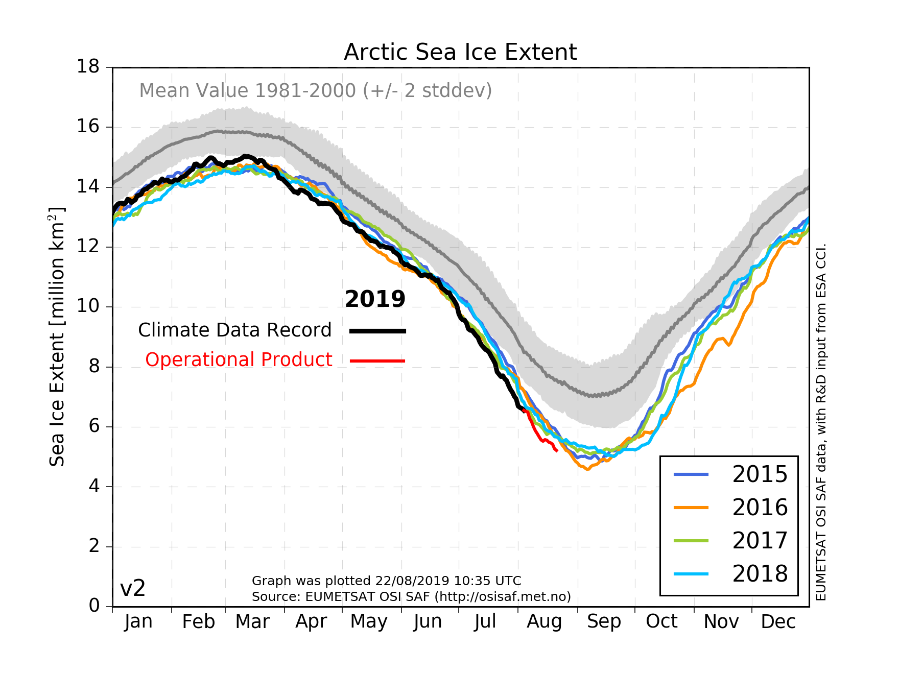
Ocean temperatures are certainly warmer than normal in the Arctic. Global SST analyses put the anomaly at least 4 to 5 deg C above climatology. The Arctic sea ice extent is at its lowest point ever for this time of year.
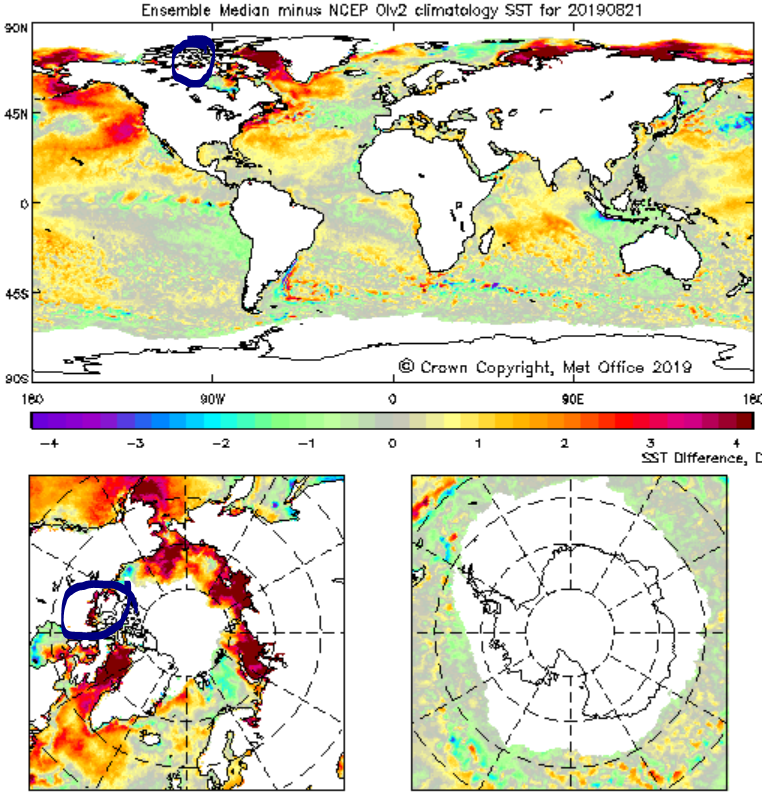
Many global SST products are struggling to capture the dynamics in the newly ice-free zones. Variance from analysis to analysis is large.
However, OceanMAPS has perhaps gone a bit too far. Strangely, the warm cell actually developed over the northern winter when the region was covered in ice. OceanMAPS doesn’t include ice so it does have difficulties in these areas, particularly when patches of ocean are surrounded by islands.
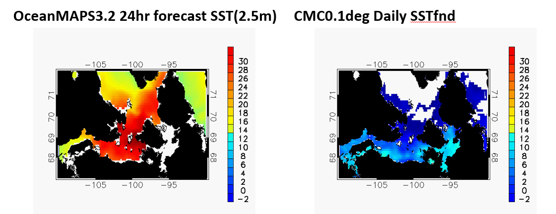
We have traced the problem back to a lack of SST observations getting into the data assimilation scheme in this spot. The rest of the Arctic is fine.
Unless you are planning a swimming trip in the Arctic next week and wondering whether to pack your survival suit or your bikini, don’t worry. We have a working group onto it.
Stay tuned for updates on the fix.

Interesting. I’d suggest one reason why you haven’t heard anything from Lord Howe is that they don’t have proper internet (only satellite)… however we do have an observer out there so they may be able to provide some reports. It was really weird when I went there for a holiday – it’s the only place I’ve seen queues for pay phones in the last 10 years and landlines the normal form of communication – they don’t have mobile either…
Here’s a link to some past erosion information: https://www.lhib.nsw.gov.au/community/news/windy-point-erosion-protection-works
Good to see the surge predicted from OceanMAPS was verified well.
I am wondering if this article is circulated to all Mets in the regions..