
SST
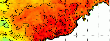
The sea surface temperature remains very warm on the North West Shelf and beyond towards Indonesia. Sea temperatures are hovering at 30 to 31 deg C, about 2 degrees above normal. The climatology indicates that it normally cools down a little by now.
This area is now effectively a reservoir of heat and moisture that could be used to trigger convection under an upper low. If the upper low then connects with a cold front along the southern states, we should see a good rainfall event for the interior and southeastern states. Watch this space.


Another warm area is in South Australia, where the Leeuwin Current extension has combined with a couple of downwelling events to push up sea temperature anomalies in a narrow band along the coast.
The EAC exit region is becoming very dynamic with sharp SST gradients off the coast of NSW. In the past few days we have seen some convective precipiation generated over this area, and it will continue to present a challenge for forecasting onshore precip events.
Below is a short loop of satellite-estimated rainfall and lightning events (fine red dots) overlaid on a SST field for NSW on Tuesday the 23rd of April 2017. We can see rainfall being generated and enhanced as the atmospheric flow approaches the coast.

Sea Level Anomalies and Ocean Currents
As mentioned above, the EAC is dynamic off NSW and generating well-defined warm-core and cold-core eddies. It is looking very likely that the main lobe of warm water south of Port Macquarie will pinch off into a closed warm-core eddy.

Sound speed
TBC.
