
SST update
Over the last week or so, we’ve seen some warming return to the northwestern shelf, while the shallow NT waters rose to 2° above average. There’s also some broader warming in the far west now.
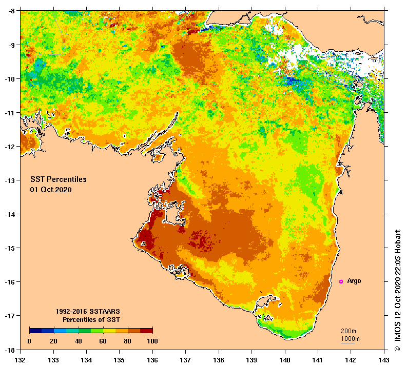
The warm areas in the east, standing out in the chart below, are warm core eddies that formed last month off the East Australian Current and Tasman Front. The largest is off the Gold Coast and is keeping that region broadly 1-2 degrees above average for this time of year.

The Joseph Bonaparte Gulf and the Gulf of Carpentaria have been warmer than average all month, coinciding with heatwave conditions in some parts of the NT.
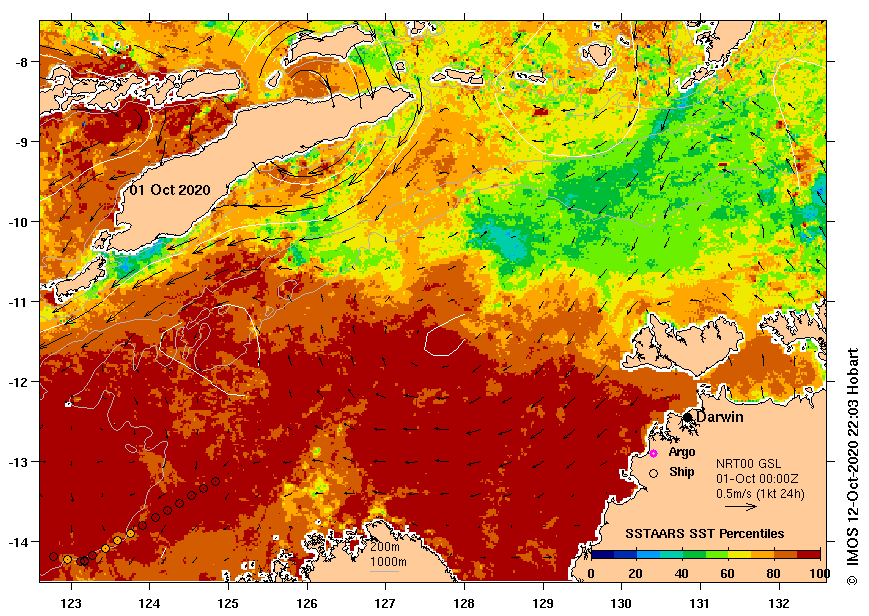
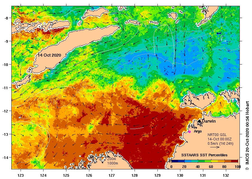
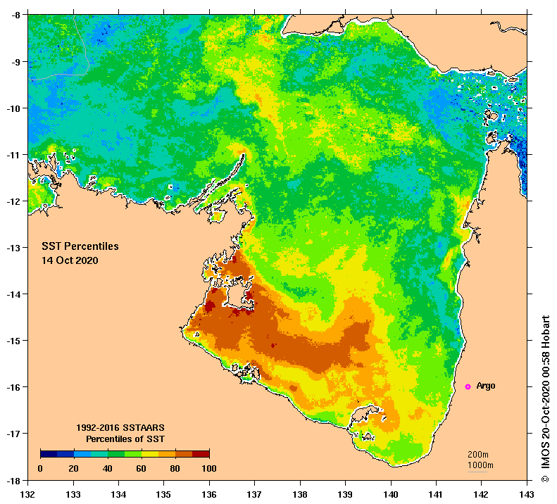
The anomaly has reduced for both gulfs since the start of the month, but OceanMAPS suggests it will linger for the next week at least. While it is not unusual for shallower waters to heat up quickly (and cool just as fast), it is worth noting that last year at the same time, we had a cool anomaly in the north.

This is a typical pattern for an El Niño year. Here’s a snapshot from 2006 showing noticeable cooling anomalies in the same area.

And, in contrast, a snapshot of 2010 in La Niña conditions suggests the region is likely to see some warmth in the next few months (remembering that the La Niña event of 2010-11 was much stronger than the current one looks to be) .

Today’s tsunami
A magnitude 7.6 earthquake off the coast of Alaska this morning triggered a tsunami alert across the Alaskan coast and parts of the Pacific.

In the end, the tsunami measured under a metre on the Alaskan coast according to the US Tsunami Warning System. Further south, Hawaii was on alert during the morning, before confirming there was no threat. A sea level rise of 30-40 cm was recorded off Maui this afternoon, and the effects from the earthquake are currently still detectable, as the chart below shows.


The epicentre of the earthquake was around 1000km away from Prince William Sound, an area with a long history of landslides (often earthquake-triggered) leading to local tsunamis. In May, media outlets featured reports that a retreating glacier has created a recently discovered area of instability and a “slow-moving landslide”. Early studies suggest that as the glacier continues to melt, an earthquake or even a heatwave may suddenly trigger a “potential rapid failure”; the release of millions of tonnes of rocks into the water below, displacing the water and creating a tsunami of up to 9 metres.

However, Alaska’s Department of Natural Resources website soberly states that the landslide may have begun as early as 1957, and that since 2016, the rate has actually slowed.

New bathymetric surveys being conducted in the area this year will help to further gauge the possible effect of any sudden shift.
