
- The RV Investigator samples the Indian Ocean
- A Frenchman in a barrel complete ocean crossing
- Warm eddy leaking heat off NSW
SST update

There have been some subtle changes to the SST pattern this week, with the cold anomalies off southern WA becoming narrower while the warm anomaly in southern NSW has strengthened.
NSW heat
Off southern NSW and eastern VIC there is a large region of water at 3 deg C above normal. The surface temperatures are 22 to 23 deg C as far south as Gabo Island which is unusual for this time of year.

The heat is related to a large warm eddy between Sydney and Ulladulla that has been moving steadily southward in the past few weeks.
However, the rapid southern spike in the anomalies seems to come from a ‘leak’ of this warm eddy. Most of the water is contained in the anti-clockwise spiral of the eddy, but an arm has escaped and has joined forces with an existing old weak feature to forming a secondary eddy. This becomes clear when we compare images two weeks apart, below.


In the week ahead OceanMAPS forecasts the SST values to cool off NSW due to the passage of two low pressure systems with accompanying strong winds and negative heat flux. Good mixing will lead to a deepening of the mixed layer depth in the region, and we should see the SST anomalies ease back by this time next week.
RV Investigator and the IO
The Research Vessel Investigator is undertaking a voyage along the 110°E meridian as part of the 2nd International Indian Ocean Expedition. The voyage left Fremantle on the 14th May and is replicating measurements that were first done over 50 years ago in 1962/1963 by Australian scientists aboard the HMAS Diamantina.

The 40-strong international team of oceanographers and marine biologists will take many ocean measurements, including:
- Conducting 20 deep CTD stations at 90 mile intervals over nearly 30° of latitude.
- Launching a fleet of BoM and NOAA drifters, one ARGO float and two Teledyne APEX floats for deep Argo down to 6000m for JAMSTEC.
The voyage timed to coincide with the maximum strength of the Leeuwin Current. A quick look at the SLA images shows that at least three warm eddies have been spawned by the Leeuwin Current in recent weeks. However, it looks like they haven’t travelled west enough to intercept the ship.

ocean forecasting onboard
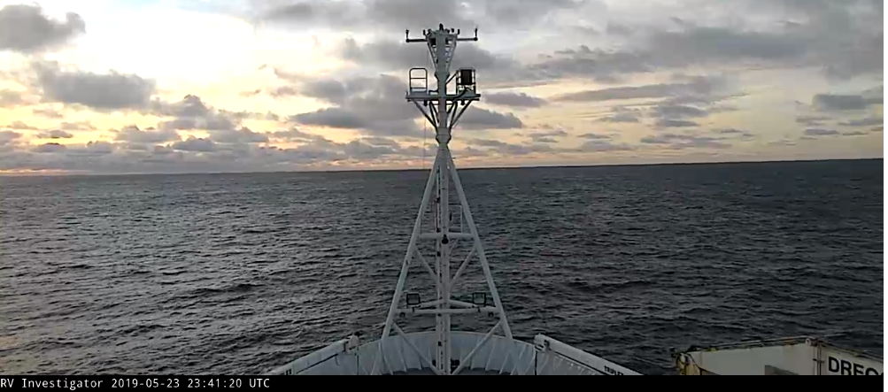
The expedition had a bumpy start with rough seas when it first reached 40 °S last week but conditions are improving as the ship transits north. You can check out the surface conditions on the live webcam.
What about the subsurface? How will the oceanographers know the ocean conditions that they are sampling?
To address this problem Paul Sandery from CSIRO has set up an ocean nowcasting system whereby the ship’s location is sent to NCI, then OceanMAPS forecasting images are produced and sent back to the ship. This gives targeted information to the oceanographers without the need for expensive bandwidth. It also enables near-realtime comparison of measurements to the model.

When the expedition returns to shore we hope to gain some feedback on how OceanMAPS performed, and if the nowcast system helped their operational and scientific planning.
A Frenchman and his barrel
Jean-Jacques Savin has successfully crossed the Atlantic Ocean in a barrel.

In a post in January we described the 72-year old Frenchman’s ambitious attempt to float across the ocean with only currents for propulsion, and freeze-dried food and foie-gras to eat.
He intended to reach the Caribbean by March with an average speed of 1.1 knots.
By the end of March his supplies were running out, so the NOAA Research ship Ronald H. Brown intercepted the barrel and gave him extra provisions.

On the 27th of April Jean-Jacques drifted into Dutch Caribbean waters, declared the trip a success, and was picked up by a Dutch oil tanker. The tanker dropped him off on the island of St Eustatius after 122 days at sea.
From the Canary Islands to St Eustatius is 2684 nautical miles. The journey was 122 days = 2928 hours.
Average speed = 0.92 knots.
As we speculated in January, it is unlikely that ocean currents were the sole means of propulsion, as the North Equatorial Current has an average speed of only 0.2 knots. The main propulsion came from windage.
Jean-Jacques said that he had only eight rough nights at sea, but the winds weren’t always favourable and this extended his trip. He had two narrow misses with oil tankers. Jean-Jacques described the feeling of being at sea as “complete freedom”(NY Times interview).
