
SST
This past two weeks we have seen significant cooling in the sea surface temperature in the tropics. With temperatures out to sea now around normal for this time of year. Inshore we can see that tidally-driven cooling creating an inshore temperature front across WA, NT and QLD.

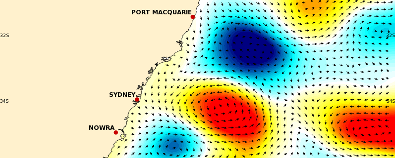
SLA and currents
Off NSW later this week the cold eddy will complete its westward journey to the coast and completely cut off the warm eddy to the south. If you remember, this eddy off Sydney used to be a huge warm lobe at the southern end of the EAC. Now the EAC ends further north.

Looking at SLA for WA, we can see that due to downwelling (mentioned last week) the sea level is already elevated along the coast. As the cold front approaches, the sea level will build even more due to storm surge. Then this will kick start a coastally-trapped wave of elevated sea levels that will travel around the south of the country.


The sea level viewer shows HAT is expected to be exceeded in quite a few places as this SLA anomaly propagates. In Perth on the 25th, Esperance on the 27th, Adelaide on the 29th and Victoria on the 30th.

